By Staff, July 15, 2015 at 12:00 PM
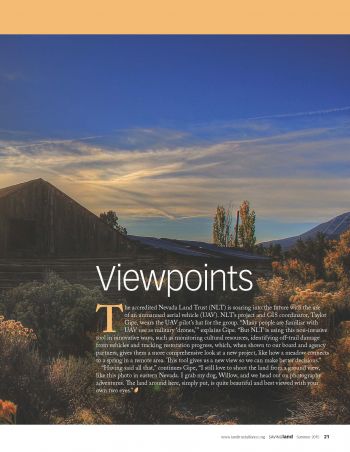
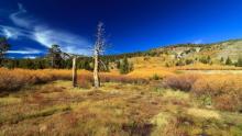
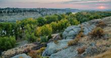
The accredited Nevada Land Trust (NLT) is soaring into the future with the use of an unmanned aerial vehicle (UAV). NLT’s project and GIS coordinator, Taylor Gipe, wears the UAV pilot’s hat for the group. “Many people are familiar with UAV use as military ‘drones,’” explains Gipe. “But NLT is using this non-invasive tool in innovative ways, such as monitoring cultural resources, identifying off-trail damage from vehicles and tracking restoration progress, which, when shown to our board and agency partners, gives them a more comprehensive look at a new project, like how a meadow connects to a spring in a remote area. This tool gives us a new view so we can make better decisions.” “Having said all that,” continues Gipe, “I still love to shoot the land from a ground view, like this photo in eastern Nevada. I grab my dog, Willow, and we head out on photography adventures. The land around here, simply put, is quite beautiful and best viewed with your own two eyes.